
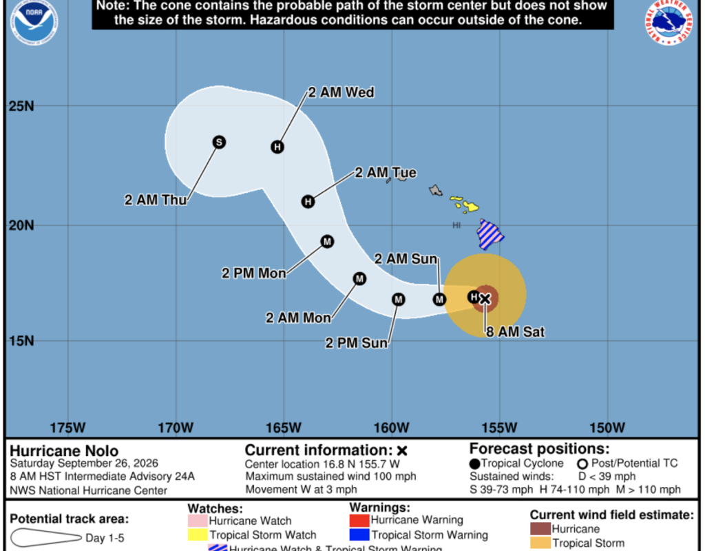
Hurricane Nolo continues to linger precariously south of the Big Island, maintaining its strength as a Category 2 storm with sustained winds reaching 100 mph. According to the Central Pacific Hurricane Center, the system has been nearly stationary, drifting slowly westward at just three miles per hour. Forecasters warn that Nolo is likely to intensify further, potentially becoming a major Category 3 hurricane by tonight or early Sunday before peaking in intensity on Monday.
While the projected path suggests the center of the storm will stay well south and southwest of the main islands, its outer bands are already making their presence felt. A Hurricane Watch and Tropical Storm Warning remain active for Hawaii County, while a Tropical Storm Watch covers Maui County. Residents across all islands are being urged to stay vigilant as gusty winds and dangerous surf conditions persist throughout the weekend.
The most severe threats are currently concentrated on the eastern and southern sides of Hawaii Island, where staggering amounts of rain are expected. Some areas could see an additional four to eight inches of rainfall, contributing to overall storm totals that may hit 25 inches in some spots. Local officials warn that these volumes could trigger life threatening flooding and mudslides, particularly in regions with steep terrain. Similar risks exist for eastern Maui, where total rainfall could reach up to ten inches.
Along the coastline, the danger extends beyond the rain. A combination of high tides and a dangerous storm surge is expected to push seawater into normally dry coastal areas in Hawaii County. Combined with massive swells hitting east and south facing shores, beachgoers and residents are being warned away from the water due to life threatening rip currents and surging waves that will likely spread westward over the coming days.